
News
TaiwanICDF, Nicaraguan Government Agencies Sign MOU, Extend Cooperation on GIS Technologies
With natural disasters having inflicted major loss of life and property upon its Central American partner countries over many years, in 2009 the Ministry of Foreign Affairs commissioned the International Cooperation and Development Fund (TaiwanICDF) to implement a project, Application of GIS to Improve Environmental Sustainability and Reduce Risk in Nicaragua, in cooperation with the Nicaraguan Institute of Territorial Studies (Instituto Nicaragüense de Estudios Territoriales, INETER) and the Ministry of the Environment and Natural Resources (Ministerio del Ambiente y los Recursos Naturales, MARENA). The project is now into its fourth year of implementation.
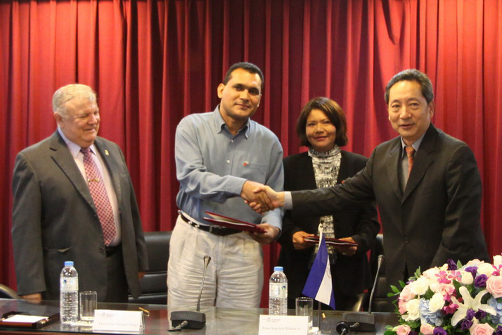
To regulate the scope of cooperation and the project’s regional content, the TaiwanICDF hosted a ceremony today, October 21, to sign a working-level memorandum of understanding (MOU) with representatives of INETER and MARENA. Agreements formalized in the MOU will support the Nicaraguan government’s environmental protection activities and provide authorities with access to satellite-imaging technologies so that large-scale natural disasters can be monitored and appraised in real time, and so that appropriate contingency measures can be put into place.
For Taiwan, the principal project stakeholder continues to be the National Central University and its Center for Space and Remote Sensing Research. With the project already into its fourth year of implementation, 2012 will see the project’s main participants, INETER and MARENA, joined by staff at National Agricultural University (Universidad Nacional Agraria, UNA) and the Ministry of Agriculture and Forestry (Ministerio Agropecuario y Forestal, MAGFOR). The scope of environmental monitoring activities will also be expanded to include cooperation with the World Bank in the Bosawas Biosphere Reserve─often dubbed the “green heart” of Central America─as well as protected areas around the Omepete, Masaya and San Cristobal volcanoes, and Tisma, an area prone to flooding. By publicizing the quality of Taiwan’s GIS and remote sensing technologies, Taiwanese authorities expect that the current project will generate opportunities to pursue similar cooperative projects in other partner countries.
In future, the TaiwanICDF will continue to call upon Taiwan’s experience in GIS and environmental protection as a basis for cooperation. Regional development strategies for GIS-related cooperation projects will first be analyzed and appraised according to information gained from the current project, which will continue to focus on the proper use of Taiwan’s Formast-2 satellite and of existing resources available among Central American partner countries. By combining to produce a new cooperation model, such operations represent a further milestone in Taiwan’s use of technology in its foreign assistance work.
•About Nicaragua
The largest country in Central America, some 30 percent of Nicaragua’s territory is designated as national reserves. Lake Nicaragua, the largest lake in Latin America, is dotted with small islands and rich in fish and shrimp. Nicaragua is also home to more than twenty volcanoes, which form a chain running from north to south down the entire length of the country. The nation’s richest agricultural and pastoral land lies in a central region along the west coast, where these spectacular and mysterious volcanoes have blessed Nicaragua with fertile soils, beautiful landscapes, freshwater resources and lakes, as well as tourists. Yet their presence also brings genuine danger in the form of earthquakes and eruptions: Due to frequent seismic activity, Nicaragua’s capital, Managua, is often referred to as the “Earthquake Capital of the World.”
Related Pictures
- Update: 2018/03/01
- Hits:315