Guatemala
Early Warning and Disaster Management System Project

Themes
-
 Environment
Sustainable Development Goals (SDGs)
 13.Climate Action
Project Name:Early Warning and Disaster Management System Project
Project status:Projects in Operation
Cooperating Country:Guatemala
Project Description:
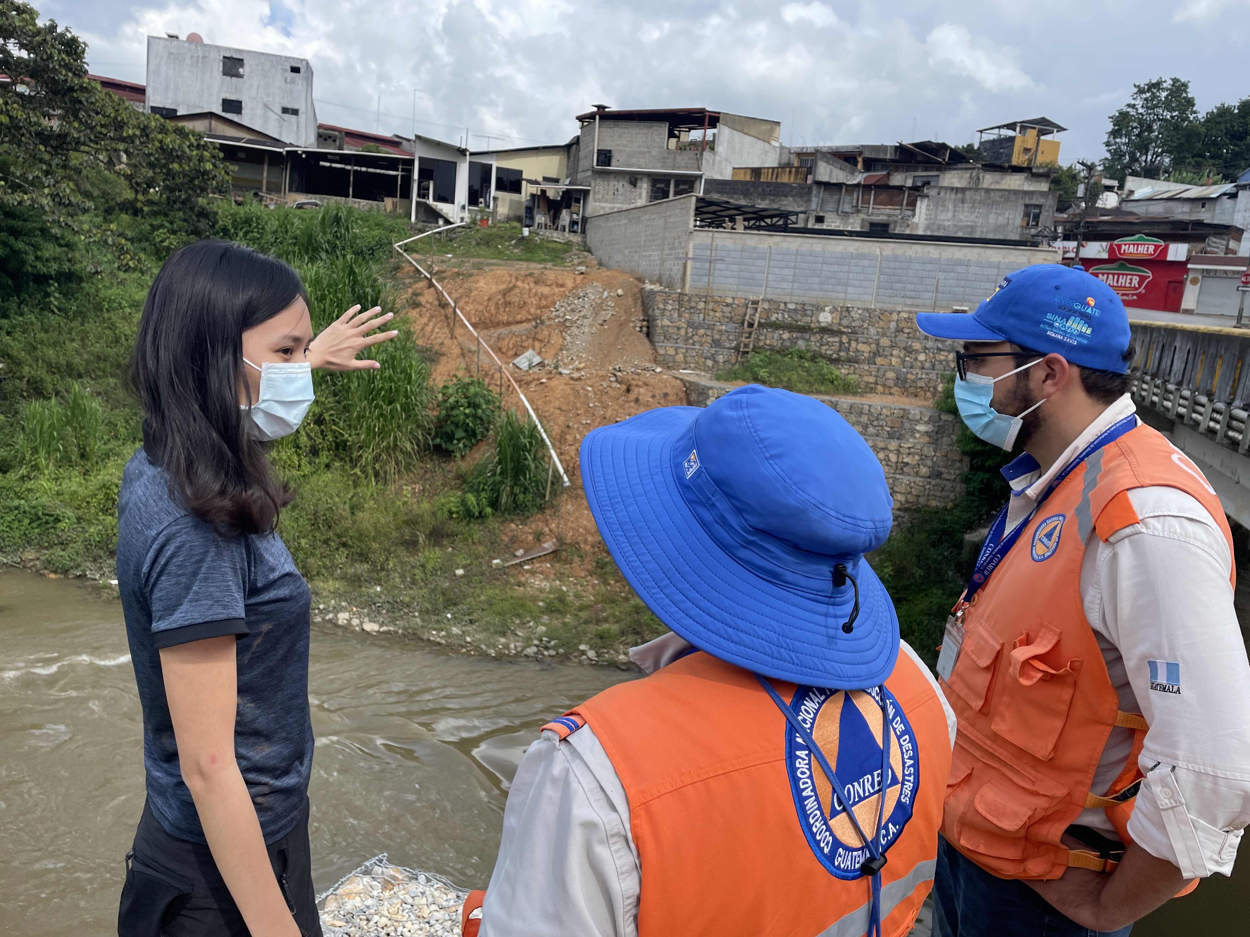
Guatemala faces a variety of natural disasters. Floods and landslides are caused by torrential rains, tropical storms, and hurricanes during the rainy season each year. Consequently, much of the terrain has been destroyed and many people live in high-risk disaster areas. In view of these challenges, this project leverages climate information and technological disaster prevention tools to improve Guatemala’s resilience. The main contents of the plan include: (1) integrating flood and landslide disaster response information and building a disaster prevention and early warning information platform to assist decision-making; (2) establishing four disaster-prevention communities; and (3) improving the environmental monitoring system in the demonstration area.
、
Project No:TT-410-2021-029
Region:Central America
Implementation Start Date:2023-07-06
Implementation End Date:2025-12-31
Project Objectives:
The project will strengthen the response capacity for flood and landslide threats in the municipalities of San Pedro Carchá and Cobán in the department of Alta Verapaz through the installation of early warning systems, which will assist decision-making in the Cahabón river basin and thus achieve a 30% reduction in the response time in the demonstration areas.
Executing Agency:
National Coordinator for Disaster Reduction (CONRED), Guatemala / Taiwan Investment and Trade Service Mission in Central America
Current Progress:
To the end of March 2024, the following activities have been completed:
1. 3 IoT monitoring stations have been installed in Cahabón river basin, and those IoT stations have been collecting real-time environmental monitoring data on-site.
2. Created and integrated geospatial data to generate 1 preliminary flood simulation model with the 100-year return period for the Cahabón river basin; which continued with the simulation of flooding scenarios, including the situations of 50mm, 150mm, and 300mm percipitation.
3. Completed 1 disaster risk map for the Cahabón basin.
4. Held 2 technical conferences with 120 participants and 234 online views.
5. Conducted 2 disaster response technical training courses for professional technical personnel, with a total of 85 participants obtaining drone flying certifications.
6. Held 5 workshops and 19 training sessions in 3 local communities, with approximately 520 participants.
7. Conducted interview surveys in 59 households to raise disaster risk awareness.
Project Contact:Alin Chen
Phone:+886228886046
E-mail:a.l.chen@icdf.org.tw
Signing Date:2023-07-06
- Update:2024-04-30
- Hits:685